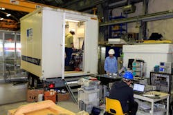
Transportable optical clock used to measure gravitation for the first time
A European collaboration involving clock experts from the National Physical Laboratory (NPL; Teddington, England), the Physikalisch-Technische Bundesanstalt (PTB; Braunschweig, Germany) and the Istituto Nazionale di Ricerca Metrologica (INRIM; Torino, Italy) has used PTB's transportable optical atomic clocks to measure gravitation for the first time.1
Until now, such delicate clocks have been restricted to laboratories at a few major research institutions; however, researchers at PTB have developed a transportable strontium optical lattice clock, opening up the possibility of performing measurements in the field.
The transportable clock was driven in a vibration-damped and temperature-stabilized trailer to the French Modane Underground Laboratory (LSM). Operated by Centre National de la Recherche Scientifique and Grenoble-Alpes University, the multidisciplinary lab is located in the middle of the Fréjus road tunnel between France and Italy. There, the team measured the gravity potential difference between the exact location of the clock inside the mountain and a second clock at INRIM, located 90 km away in Torino, Italy at a height difference of about 1000 m.
Comparison via fiber-optic link
The accurate comparison of the two clocks was made possible using a 150 km long fiber-optic link set up by INRIM and a frequency comb from NPL to connect the clock to the link. Researchers from Leibniz Universität Hannover also determined the gravity potential difference using conventional geodetic techniques, and the two measurements were shown to be consistent.
With improvements to the accuracy of the transportable optical clock, this technique has the potential to resolve height differences as small as 1 cm across the Earth's surface. The advantage of using optical clocks is that they can make measurements at specific points, in contrast to satellite-based measurements, such as GRACE and GOCE, which average the gravity potential over length scales of about 100 km.
This novel method could lead to higher resolution measurements of the Earth's gravity potential, allowing scientists to monitor, with unprecedented accuracy, continental height changes related to sea levels and the dynamics of ocean currents. It will also lead to more consistent national height systems.
Currently, different countries measure the Earth's surface in the same way, but relative to different reference levels. This has led to problems – one such being the Hochrhein Bridge between Germany and Switzerland, where construction on each side used different sea-level calculations, leading to a 54 cm discrepancy between the two sides.
Source: https://www.ptb.de/cms/en/presseaktuelles/journalisten/news-press-releases/press-release.html?tx_news_pi1[news]=8725&tx_news_pi1[controller]=News&tx_news_pi1[action]=detail&tx_news_pi1[day]=12&tx_news_pi1[month]=2&tx_news_pi1[year]=2018&cHash=85a973e4ef56b4c24ffadc406364f23c
REFERENCE:
1. Jacopo Grotti et al., Nature Physics (2018); doi: 10.1038/s41567-017-0042-3

John Wallace | Senior Technical Editor (1998-2022)
John Wallace was with Laser Focus World for nearly 25 years, retiring in late June 2022. He obtained a bachelor's degree in mechanical engineering and physics at Rutgers University and a master's in optical engineering at the University of Rochester. Before becoming an editor, John worked as an engineer at RCA, Exxon, Eastman Kodak, and GCA Corporation.
