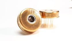
Excelitas APDs map forest canopy and terrain for NASA’s GEDI program
Excelitas Technologies (Waltham, MA), a global technology company offering customized photonic solutions, contributed its avalanche photodiode (APD) technology to NASA’s GEDI instrument currently orbiting Earth on the International Space Station (ISS). Excelitas said it wishes to congratulate NASA and the University of Maryland team led by Dr. Ralph Dubayah for the first release of data after all in-flight validation and testing was completed.
GEDI (Global Ecosystem Dynamics Investigation), launched in late 2018, is actively mapping Earth from the ISS on a 2-year mission to provide extremely high-resolution 3D images of forest canopy structure and land elevation. Year-over-year variations in vegetation density and their resulting impact to the carbon cycle are key elements in modeling climate changes and humanity’s impact on our planet.
GEDI models will further enhance data being developed by other Earth-observation missions that are monitoring the evolution of structures on Earth. The contribution of GEDI to enhanced weather forecasting, forest management, glacier and snowpack monitoring, and other applications is expected to be immeasurable. Following validation of structure measured by the NASA LVIS mission, (also using Excelitas APDs), the first data sets have been released to the pubic via the Land and Processes Distributed Active Archive Center (LP DAAC), allowing all climate scientists to correlate GEDI data to their own.
“We’re proud and humbled to have provided custom space-qualified hybrid receivers to NASA for this mission,” said Eric Desfonds, Excelitas Product Line Manager, Defense and Aerospace Sensors. “For several decades, we have been honored to collaborate so closely with the NASA Goddard team as they continue to aim for bold scientific goals. Building upon our modules delivered for several prior missions, Excelitas Canada designed, screened and qualified some of our very best YAG-enhanced APDs to enable reliable detection of the faint signal bounced back from Earth after traveling over 800 km."
Read the full story at the link below.
SOURCE: Excelitas; https://www.excelitas.com/press-release/excelitas-avalanche-photodiodes-apds-enable-nasas-gedi-ecosystem-lidar-map-earths

Gail Overton | Senior Editor (2004-2020)
Gail has more than 30 years of engineering, marketing, product management, and editorial experience in the photonics and optical communications industry. Before joining the staff at Laser Focus World in 2004, she held many product management and product marketing roles in the fiber-optics industry, most notably at Hughes (El Segundo, CA), GTE Labs (Waltham, MA), Corning (Corning, NY), Photon Kinetics (Beaverton, OR), and Newport Corporation (Irvine, CA). During her marketing career, Gail published articles in WDM Solutions and Sensors magazine and traveled internationally to conduct product and sales training. Gail received her BS degree in physics, with an emphasis in optics, from San Diego State University in San Diego, CA in May 1986.
